
Before you choose
What you need to know about this experience
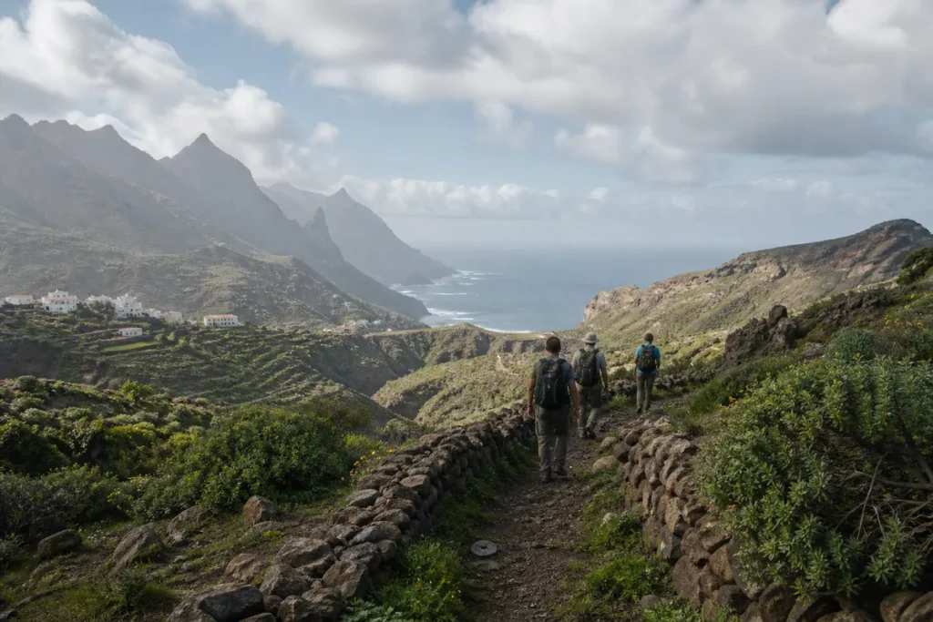
Guided hiking in Teno means a walking route with a guide through Teno Rural Park, the massif in north-west Tenerife, outside the Masca gorge: ridge-top hamlets such as Teno Alto, viewpoints over cliffs, old royal paths (caminos reales) and areas of monteverde (laurel and heath forest). It is usually a less crowded alternative to Masca, without its booking system.
This page helps you choose a route to suit your level and understand access to the massif. If you want to hike down the Masca gorge, see its dedicated page.
At a glance
| Aspect | What to expect |
|---|---|
| What it is | Guided hiking route through Teno Rural Park |
| Area | About 8,000 hectares in Buenavista del North, Los Silos, El Tanque and Santiago del Teide |
| Landscape | Monteverde, cliffs, ravines, traditional hamlets |
| Levels | Moderate to demanding; some sections unsuitable for people with vertigo |
| Duration | From about 3 hours to a full day |
| Permits | The usual trail network does not require booking, unlike the Masca gorge |
| Access roads | TF-436, TF-445 (regulated towards Punta de Teno) and TF-82 |
| Price | Depends on the provider, the route and the format |
Common routes by level
| Route | Indicative level | What it offers |
|---|---|---|
| Mirador de Baracán – Teno Alto (PR-TF 51) | Moderate | Ridges, views of the Teno valley and a traditional hamlet |
| El Palmar – Los Bailaderos (PR-TF 57, Callejón de Teno) | Moderate | Starts at the park visitor centre in El Palmar |
| Teno Alto – Buenavista (PR-TF 58, Camino del Risco) | Demanding, with exposed sections | An old path overlooking the northern cliffs |
| Teno Alto – Punta de Teno (PR-TF 51) | Demanding, long descent | Descent to the lighthouse with views of Los Gigantes and La Gomera |
| Los Carrizales | Demanding, narrow sections | Isolated hamlet and farm paths |
Levels are indicative. Some sections have overgrown vegetation or loose stones; always check the trail status on Tenerife ON.
Why Teno as well as Masca
- Less crowded and no booking or compulsory transport.
- Variety: monteverde on the ridges and cliffs on the coast.
- Traditional hamlets, such as Teno Alto, with threshing floors and rural architecture.
- Views of Los Gigantes, La Gomera and, on clear days, Teide.
Access and transport
- TF-436 (Buenavista – Masca – Santiago del Teide): during periods of wildfire risk, the Cabildo has applied access controls on the Masca section.
- TF-445 towards Punta de Teno: access regulated all year round; during the controlled hours you can only go by bus (route 369) or taxi, according to Buenavista del North Town Council.
- Buses: several routes reach starting points in the park. Check timetables on titsa.com.
Many routes are linear. A guide with a vehicle solves the return to the starting point.
What a guide adds
- Choosing the right route for your level and the weather.
- Sorting out the logistics of linear routes.
- Explaining the plants, wildlife and rural history of the massif.
- More safety on exposed or poorly waymarked sections.
Who it suits
- Hikers looking for routes less crowded than Masca.
- Anyone who has already done Masca and wants to see the rest of the massif.
- Lovers of cliff landscapes and traditional hamlets.
Who it may not suit, and what to weigh up
- People with vertigo: some paths, such as the Camino del Risco, have exposed sections.
- Low fitness: the height differences are considerable.
- Days with wind, rain or wildfire alerts: trails or access roads may close.
How to choose well
- Which route, how many kilometres and how much ascent?
- Are there exposed sections?
- Linear or circular? How do you get back?
- Is transport from your area included?
- What training does the guide have?
- Is insurance included?
- What is the alternative plan if an access road closes?
What is usually included and what to check
| Item | Usual practice | Check |
|---|---|---|
| Guide | Included | Training and language |
| Transport | In some offers | Pick-up area |
| Insurance | Common | That it is included |
| Food and water | Not included | Bring your own |
Safety
- Vertigo and exposed sections: follow the guide’s instructions.
- Loose stones and damp: mountain footwear with good grip.
- Wind on ridges and clifftops.
- Trail status: check notices on Tenerife ON.
Weather
- The ridges of the massif get cloud and humidity from the trade winds.
- The coast and the Punta de Teno area are usually drier and sunnier.
- In summer, heat in the lower areas and possible restrictions due to wildfire risk.
Price: what it depends on
We do not give a reference figure.
- Route and duration.
- Transport included.
- Group or private.
What to bring
- Hiking boots with good grip.
- Layers and a windproof jacket.
- Plenty of water and food.
- Sun protection and a cap.
- Walking poles for the long descents.
Alternatives and how to compare them
| If you are looking for… | Best option |
|---|---|
| Hiking down the Masca gorge | Masca gorge hike |
| Seeing Masca and the north-west by vehicle | Masca, Teno and Garachico excursion |
| Hiking with laurel forest in the north-east | Guided hiking in Anaga |
| Birdwatching | Birdwatching in Tenerife |
Frequently asked questions
Do you need to book to walk in Teno?
Not for the usual trail network. The Masca gorge does require a booking.
Which Teno route is best known after Masca?
The ones through Teno Alto and the Mirador de Baracán, and the Camino del Risco towards Buenavista.
Can you drive to Punta de Teno?
During the regulated hours, only by bus or taxi. Outside them, check Buenavista del North Town Council’s conditions.
Is it suitable for people with vertigo?
Some routes are not. Ask the guide about exposed sections.
How long does a guided route last?
From about 3 hours to a full day.
Are there buses to the starting points?
Yes, to several. Check timetables on titsa.com.